Remote Sensing-Based Spectral Index Mapping of Chittagong District (2024)
Published:
Spatial assessment of vegetation, built-up areas, surface water, and bare land using satellite-derived spectral indices.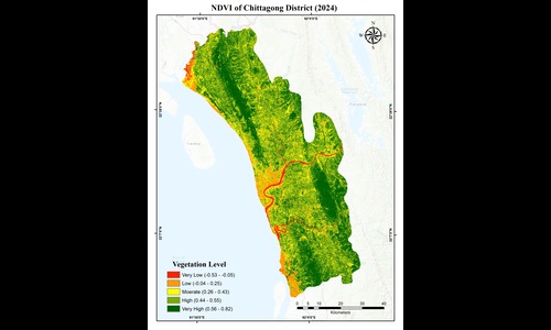
Published:
Spatial assessment of vegetation, built-up areas, surface water, and bare land using satellite-derived spectral indices.
Published:
This post contains part of my codes used during my research project on validation of ERA5 and ERA5-Land.
.png)
Paper is Under Review at Theoretical and Applied Climatology, 2026
Recommended citation: Anwoy Barua, Sanjib Ghosh, Shyamal Karmakar et al. Validation of ERA5 and ERA5-Land Reanalysis Data for Daily Air Temperature and Extreme Temperature Indices over Bangladesh, 14 October 2026, PREPRINT (Version 1) available at Research Square [https://doi.org/10.21203/rs.3.rs-11138659/v1]
View preprint
Manuscript Under Preparation , 2026
Published: